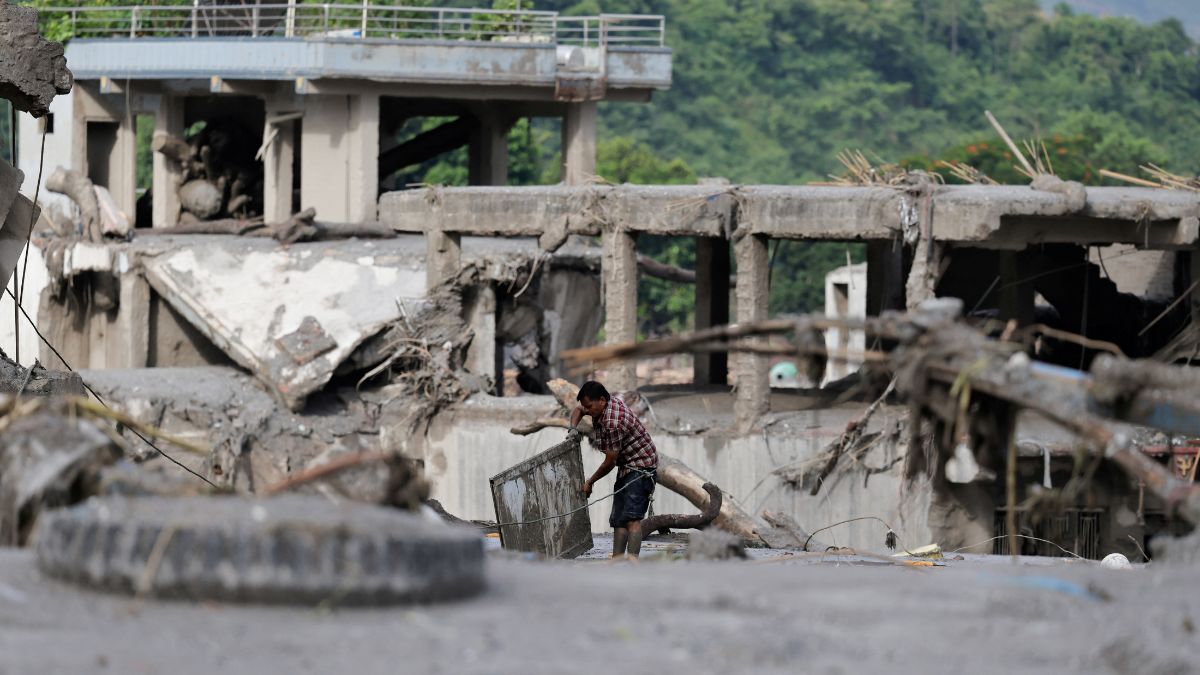
Hydrological disasters in high-altitude mountain basins operate on strict mathematical and physical constraints. When a catastrophic glacial collapse and debris flow occurs along the international boundary between Tibet and Nepal, the resulting discharge wave does not behave randomly; it follows the laws of open-channel hydrodynamics, gravity, and hydraulic routing. Understanding the mechanics of the ten-hour transboundary flood that swept down the Bhotekoshi and Trishuli river corridors requires dissecting the precise timeline, the structural failure of monitoring architecture, and the velocity of surge propagation through steep mountain gorges.
The Kinematics of the Surge
The event originated from a massive glacial collapse and debris flow near the border. Initial seismic signatures, mistakenly categorized early on as tectonic tremors, registered the sudden displacement of immense mass. Within minutes, the hydrological impulse entered the Bhotekoshi river basin in Rasuwa district, introducing an estimated additional volume of twenty million cubic metres of water and slurry into a constrained channel.
The downstream translation of this volume operates through wave celerity—the speed at which the flood wave travels relative to the actual velocity of the water particles. In steep, rocky mountain gradients, celerity is exceptionally high. The wave transitioned through specific geographic checkpoints according to a tight temporal sequence:
- 08:40 to 08:50: The Rasuwagadhi and Syabrubesi hydrometer stations recorded initial anomalies before telemetry transmission abruptly ceased, indicating physical destruction or power loss at the sensor sites.
- 09:05: Formal institutional recognition occurred as the Flood Forecasting Division received downstream entry confirmation.
- 09:15 to 09:20: Automated emergency cellular broadcasts dispatched over 600,000 warning messages to residents in Rasuwa, Nuwakot, Dhading, and Chitwan. Simultaneously, the Betrawati monitoring station went offline after logging 3.55 metres.
- 11:26: The water level at the Phurke monitoring station in Malekhu breached the designated danger mark, resulting in the structural shear and destruction of the local river bridge seventeen minutes later.
- 13:30 to 14:14: The crest passed Muglin, driving the Devghat water level to 4.76 metres, while the Kalikhola station peaked at a destructive 12.3 metres.
- 18:30: The hydrological wave receded at Devghat, completing a ten-hour translation cycle from the high-altitude origin to the confluence zones.
The Failure Modes of Infrastructure and Telemetry
The systemic vulnerability exposed by this disaster is not merely geological; it is structural and informational. River-monitoring networks in high-relief transboundary basins suffer from a terminal design flaw: they depend on localized power supplies and surface-level instruments located precisely inside the hazard zones they are meant to measure.
When the Bhotekoshi and Betrawati stations dropped offline, they created an information blackout exactly when data density was vital. Telemetry failure transforms an active monitoring system into a lagging indicator. Without real-time data input from the upper basin, predictive hydrodynamic models cannot update their boundary conditions, reducing downstream warning windows from hours to minutes.
The hydraulic force required to sweep away reinforced river bridges, such as the structure at Phurke, and inundate hydropower installations like the Langtang Khola facility, demonstrates that standard civil engineering design parameters in the Hindu Kush Himalaya region underestimate peak discharge vectors. Infrastructure resilience metrics must account for dynamic impact pressure, which scales exponentially with flow velocity and sediment concentration.
The Logistics of Vulnerability in Corridor Populations
The human cost of the ten-hour flood is heavily concentrated at the intersection of infrastructure corridors and seasonal economic migration. The timing of the disaster coincided with heavy travel periods for regional pilgrimages and local high-altitude festivals, placing hundreds of foreign nationals and domestic trekkers inside narrow river gorges.
The topography of the Trishuli and Bhotekoshi valleys restricts evacuation routes to linear highways—principally the Prithvi Highway and the Muglin-Narayanghat road corridor. When a flash flood overtakes these arteries, lateral escape is rendered impossible by vertical cliff faces. The dissemination of over 600,000 mobile alerts represents a successful quantitative reach, but the operational efficacy of an SMS warning is bounded by physical geography. An alert received ten minutes before impact is insufficient for clearing linear populations trapped in a gorge without pre-established vertical evacuation platforms.
Strategic Restructuring of Early Warning Architecture
Mitigating future transboundary flash floods requires a transition from reactive telemetry to predictive satellite-linked remote sensing. Ground-based hydrometers are inherently sacrificial assets in glacial lake outburst floods and debris flows.
Regional basin management must pivot to space-based radar interferometry and upstream precipitation monitoring combined with automated acoustic flow sensors placed high above the splash zone. Bilateral data-sharing frameworks between upstream and downstream sovereign entities must be codified to eliminate the latency between high-altitude glacial destabilization and domestic alert generation.
Deploy redundant satellite uplink transdeucers outside the immediate hydraulic footprint of river channels to ensure continuous data telemetry during extreme discharge events.