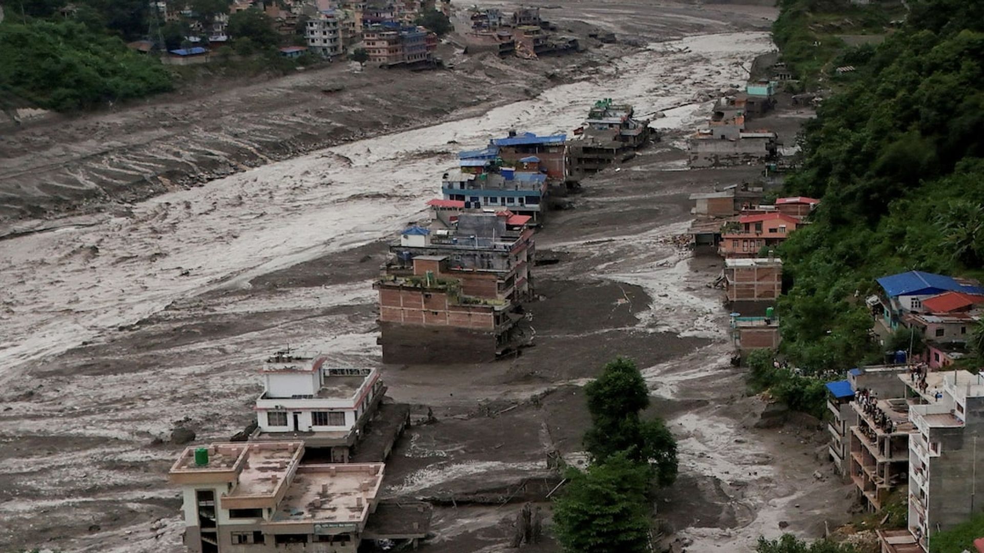
Himalayan cryospheric destabilization requires a shift from reactive emergency management to deterministic basin-wide engineering. When regional authorities announced a fifty-million-dollar, six-year initiative to lower the water levels of four high-altitude glacial lakes, the policy signaled an acknowledgment of compounding structural hazards. Yet, historical interventions—such as the three-meter reductions executed at Tsho Rolpa in 2000 and Imja Tsho in 2016—demonstrate that arbitrary volume-reduction targets driven by fiscal constraints fail to neutralize systemic risk. Mitigating Glacial Lake Outburst Floods demands an operational framework built on hydrostatic pressure equations, moraine integrity diagnostics, and real-time hydraulic discharge controls.
The Hydrostatic Mechanics of Moraine Failures
Glacial lakes are bounded by terminal and lateral moraines composed of unconsolidated rock, ice, and debris. These natural dams lack the engineered compaction and impervious core of artificial earthfill dams. As ambient atmospheric temperatures accelerate glacial meltwater influx, the volume of the lake expands, increasing hydrostatic pressure against the moraine wall.
The primary structural failure modes follow two distinct vectors:
- Piping and Internal Erosion: Hydrostatic pressure forces water through micro-channels within the ice-cored moraine, washing out fine sediments and creating progressive internal cavities until structural collapse occurs.
- Overtopping Wave Dynamics: Sub-glacial avalanches, rockfalls, or calving ice blocks displace massive volumes of water, generating displacement waves that overtop the moraine crest, rapidly eroding the unreinforced downstream slope through headward scour.
Lowering a lake's surface elevation by three meters reduces total storage capacity, but it does not alter the geotechnical stability of the moraine itself. If the structural matrix remains saturated or ice-cored, seismic shocks or heavy monsoon precipitation can still trigger catastrophic dam failure.
The Capital Allocation and Engineering Bottleneck
Executing high-altitude civil works presents extreme logistical constraints. Construction windows are restricted by severe weather, high-velocity winds, and sub-zero temperatures. Heavy earthmoving equipment, generators, and specialized pumping apparatus must frequently be airlifted by heavy-lift helicopters due to the absence of access roads above four thousand meters.
These operational friction costs create a capital allocation barrier:
- High Fixed Mobilization Costs: Transporting infrastructure to remote basins consumes a disproportionate share of project budgets before excavation even begins.
- Contractor Aversion: Commercial construction firms frequently avoid high-altitude public tenders due to safety hazards, unpredictable geological conditions, and supply chain fragility. Consequently, execution often falls to state military engineering corps.
- Incomplete Drainage Trajectories: Past projects stalled short of their design specifications because initial funding envelopes were exhausted once immediate crisis perception subsided, leaving lakes at intermediate, unverified risk thresholds.
Basin-Wide Diagnostics and Diagnostic Deficits
Targeting four specific water bodies out of over two thousand glacial lakes across Nepal illustrates the challenge of hazard prioritization. Past classifications relied heavily on remote sensing inventories and surface-area metrics. However, surface area correlates poorly with structural instability; a small lake with an unstable, ice-cored moraine poses a higher immediate threat than a larger lake buttressed by stable bedrock.
An accurate risk assessment must transition from static inventory mapping to dynamic geophysical profiling:
- Bathymetric Mapping: Conducting continuous underwater sonar surveys to track sub-surface volume shifts, thermal convection, and ice-core degradation within the basin.
- Geotechnical Telemetry: Installing pore-water pressure sensors and inclinometers within the moraine walls to monitor real-time displacement and saturation levels.
- Automated Siphon and Drainage Channels: Replacing manual or single-pass excavation with regulated, gated siphon systems or controlled artificial outlet channels that permit continuous, adjustable discharge regulation rather than one-off emergency cuts.
Strategic Execution Framework
To transform flood risk mitigation from an ad-hoc response into a predictable engineering discipline, institutional frameworks must enforce a three-stage operational sequence.
First, comprehensive bathymetric and geophysical testing must precede any earthworks. Engineering designs must dictate the target water-level reduction based on finite element slope stability models rather than arbitrary fiscal caps.
Second, outlet control structures must incorporate self-regulating siphon networks paired with robust spillways, ensuring that rapid snowmelt spikes or seismic displacement events discharge through reinforced channels rather than eroding raw moraine material.
Third, downstream vulnerability management must couple structural drainage with automated early-warning telemetry. Sensor-laden hydrological stations placed along river corridors must maintain direct integration with community-level response protocols, compensating for the residual probability of failure inherent in high-mountain cryospheric engineering.