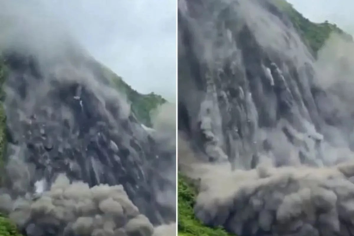
The propagation of high-altitude cryogenic hazards into lowland river basins exposes structural vulnerabilities in cross-border disaster response frameworks. When cryogenic anomalies—such as rock-ice avalanches and debris flows originating in the high Himalayas—intercept major transboundary water networks, the resulting hydrological shockwaves defy standard meteorological forecasting models. Analyzing the cascade from upper riparian zones to lower riparian floodplains requires a strict decomposition of physical triggers, transmission velocities, and attenuation variables.
The Mechanics of High-Altitude Hydraulic Disruption
Standard riverine flood models rely on cumulative precipitation metrics and seasonal monsoon curves. However, the catastrophic events witnessed in the upper catchments of the Bhotekoshi and Trishuli river networks stem from cryospheric destabilization rather than simple rainfall saturation.
When mass-wasting events—specifically rock-ice avalanches from massifs like Lirung—dislodge millions of cubic meters of material into steep gorges, two immediate physical phenomena occur:
- Kinematic Wave Amplification: The sudden displacement of water and rock creates an hyper-concentrated debris flow that moves at velocities far exceeding normal baseflow dynamics. Kinetic energy transforms into thermal energy upon impact, accelerating localized ice-melt and augmenting the volume of the flood surge.
- Transient Barrier Formation: Debris torrents frequently choke narrow mountain canyons, forming unstable natural dams or barrier lakes. The subsequent failure or controlled overflow of these impoundments introduces secondary pulse waves that propagate downstream with little warning time.
These mechanisms reduce the warning window for downstream communities from hours to minutes, rendering traditional empirical gauge-reading systems insufficient for real-time tactical evacuation.
Transboundary Hydraulic Propagation and Attenuation
The translation of an upstream catastrophe in Nepal and the Tibet Autonomous Region into an actionable downstream threat in the North Indian plains of Bihar and Uttar Pradesh involves specific hydro-geographical pathways.
The primary vector for these transboundary surges is the Narayani river system (known as the Gandak in India) along with the Kosi and Ghaghra corridors. As high-energy flows exit the steep gradient of the Siwalik Hills and enter the alluvial plains, the hydraulic profile changes fundamentally:
- Velocity Decay and Channel Spreading: As the gradient flattens, the forward velocity of the flood wave decreases, but the lateral inundation potential increases. High sediment loads settle out of the water column, raising riverbeds through aggradation and reducing the effective carrying capacity of embankments.
- The Discharge Differential: Downstream risk is a function of peak discharge volume relative to existing channel capacity. When barrages such as the Valmikinagar installation receive sudden upstream spikes, managing the discharge rate requires balancing barrage safety against downstream embankment integrity.
If the volume of incoming water outpaces the designed safe-passage threshold of the river training structures, lateral spillover threatens low-lying agrarian tracts in districts such as West Champaran, East Champaran, Gopalganj, Sitamarhi, Maharajganj, and Kushinagar.
Vulnerability Matrices in Lowland Alluvial Zones
The exposure of Bihar and Uttar Pradesh to Himalayan flash floods is dictated by geomorphological and infrastructural variables rather than direct meteorological inputs within state boundaries.
The primary exposure vectors include:
- Embankment Integrity: Many river training structures along the Kosi and Gandak systems act as artificial constraints, forcing aggraded rivers to flow at levels higher than the surrounding countryside. A rapid hydraulic surge increases hydrostatic pressure on these earthen levees, elevating the probability of piping failures and micro-breaches.
- Drainage Congestion: Tributary outfalls often lock when main stem river levels rise sharply. This causes backwater effects, flooding interior lowlands even before primary embankments are directly breached.
- Lead-Time Constraints: Because the time-of-travel for a flood wave from the central Himalayan transition zone to the North Indian border points can be compressed during high-velocity debris flows, institutional response times are tightly squeezed between automated sensor telemetry alerts and ground-level mobilization.
Operational Resource Allocation and Mitigation Protocols
Mitigating the impact of transboundary hydrological shocks demands an operational shift from reactive disaster management to predictive hydraulic risk engineering.
- Deploy High-Frequency Cryospheric Telemetry: Install automated acoustic flow sensors and real-time turbidity meters along upper riparian gorges (such as the Bhotekoshi and Trishuli corridors) to detect debris flows prior to water-level rises at border gauges.
- Dynamic Barrage Operations: Transition from static operating rules to predictive, volume-based release algorithms at key border infrastructure like the Valmikinagar barrage to flatten downstream peak hydrographs.
- Vulnerability Mapping via Sediment Transport Modeling: Update floodplain zoning maps to account for channel aggradation and debris deposition patterns, ensuring that rural infrastructure investments avoid high-risk lateral spill zones.
Fubu Toy review
This video provides a regional news report and visual context regarding the flash flood alerts and river monitoring systems deployed across northern regions following upstream hydrological disturbances.