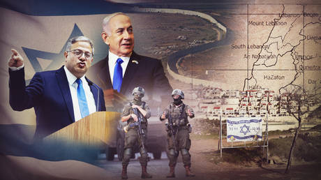
The map of the West Bank is dissolving. What was once envisioned as a contiguous territory for a future Palestinian state has been fragmented by a coordinated, multi-layered expansion of Israeli settlements. This is not a erratic rush by rogue actors. It is a highly organized administrative and territorial offensive operating simultaneously across four distinct fronts. By shifting legal authorities, building exclusive infrastructure, and legalizing deep outposts, the current bureaucratic apparatus has effectively dismantled the foundational frameworks of the Oslo Accords.
The strategy moves faster than international diplomacy can react. While global attention remains fixed on high-intensity military conflicts, the quiet mechanics of land registration, road construction, and administrative restructuring are fundamentally altering the geography of the region. This is an irreversible structural overhaul.
The Administrative Front and the Civilian Shift
For decades, the West Bank was governed primarily through the Israeli military's Civil Administration. This structure maintained a thin veneer of temporary occupation under international law, keeping management within the chain of command of the Israel Defense Forces. That operational model is gone.
A massive bureaucratic transfer shifted control over civilian life, planning permission, and land allocation from military commanders to a newly created civilian Settlements Administration. This administrative maneuver changes everything. By placing land management under a civilian ministry, the state has effectively integrated the governance of these territories into its domestic operations without a formal declaration of annexation.
The consequences on the ground are immediate. The newly established civilian authority has initiated a sweeping program to register massive tracts of West Bank land as state property. The registration process demands that local residents provide historic deeds and tax records within impossibly narrow windows. If a parcel cannot be verified through these hyper-specific mechanisms, it is cataloged as public territory and earmarked for municipal development plans.
Financial resources have followed this bureaucratic pipeline. Funding for unauthorized outposts—previously frozen or distributed covertly—now flows directly through official regional councils. This structural integration eliminates the distinction between government-approved settlements and wildcat outposts built by ideological factions. They are now treated as a singular, unified developmental project.
The Breakthrough into Areas A and B
The most aggressive operational shift is happening where Israeli civilian presence was once legally constrained. Under the terms of the historic peace frameworks, the West Bank was split into three distinct zones. Area C remained under full Israeli control, while Areas A and B were designated for varying levels of Palestinian administrative and security jurisdiction. That boundary is being systematically breached.
Settler organizations have launched campaigns to establish permanent outposts within the borders of Areas A and B. These locations were chosen with intense geographic precision. They do not merely add housing units; they target high-altitude ridges, vital road junctions, and the immediate perimeters of major cities like Nablus, Hebron, and Jenin.
- Targeting Junctions: Securing control over transit points cuts off the natural trade corridors between neighboring towns.
- Isolating Enclaves: Building outposts around urban perimeters locks Palestinian population centers into isolated municipal pockets.
- Controlling Ridges: Occupying high-altitude geography provides tactical monitoring and restricts the outward growth of existing local communities.
This push erases the internal borders that formed the basis of all previous peace negotiations. When an outpost is established deep within Area B, the military enters to protect the new residents, setting up checkpoints and exclusion zones. The territorial jurisdiction of the Palestinian Authority shrinks with every new hill occupied. It transforms a theoretically connected national territory into a collection of scattered islands surrounded by restricted zones.
The Infrastructure Grid and the E1 Cleavage
Territorial control requires physical access. The third front relies on an aggressive infrastructure campaign designed to build separate, parallel transportation networks that isolate local populations while accelerating settlement growth.
The centerpiece of this strategy is the construction of specialized bypass roads. These multi-lane corridors are designed to connect far-flung outposts directly to major cities inside Israel, completely avoiding Palestinian towns. They allow commuters from deep within the West Bank to travel to coastal economic hubs without ever stopping at a military checkpoint or seeing a local village. This connective tissue makes living in an isolated outpost economically viable for thousands of ordinary families who are simply seeking affordable housing.
[Northern West Bank]
       |
[Bypass Road] ====> Completely bypasses Palestinian towns ====> [Israel Core]
       |
[Southern West Bank]
At the heart of this infrastructure push is the reactivation of the E1 development project. Located just east of Jerusalem, the E1 corridor spans a crucial patch of land between the city limits and the massive settlement city of Ma'ale Adumim. For generations, international pressure from Washington and Brussels kept this project on hold. The logic was clear: developing E1 would completely slice the West Bank in half, preventing any north-south transit and permanently severing East Jerusalem from its West Bank hinterland.
The construction equipment is now moving. By advancing specific transportation corridors that separate local transit from settlement traffic, planners have created a workaround that allows the E1 project to proceed. The physical continuity of a potential independent territory is being permanently severed by asphalt, retaining walls, and concrete barriers.
The Outer Frontier and the Buffer Zones
The fourth front extends to the margins of the territory, targeting the Jordan Valley and the sensitive border perimeters. The Jordan Valley makes up nearly thirty percent of the West Bank, serving as its agricultural heartland and its only external border. Control here is being solidified through a mixture of industrial farming projects, nature reserves, and military firing zones.
Declaring land as a military training sector or an ecological preserve serves a distinct practical purpose. Once a zone is designated for environmental protection or military maneuvers, local herders and farmers are legally barred from entering or grazing their livestock. Over time, these depopulated zones are reallocated to agricultural settlements that establish massive date plantations and high-tech greenhouses.
This strategy relies heavily on specialized agricultural outposts. Unlike dense urban settlements, an agricultural outpost requires only a handful of individuals, a herd of sheep, and a fleet of all-terrain vehicles to control thousands of acres. These small teams project presence across vast areas, actively pushing local communities away from natural water sources and traditional grazing grounds. It is a highly efficient method of territorial acquisition that requires minimal capital expenditure but yields massive geographical dividends.
The Collapse of the Twin System Paradigm
The historical management of these territories relied on a strict conceptual division. The state maintained a civilian legal system for its citizens residing in the territories, while applying a military legal system to the local population. This dual structure is rapidly blending into a unified domestic framework.
The expansion across these four fronts has created a reality where the military increasingly serves as an enforcement arm for civilian planning bodies. When an outpost expands, the defense establishment is legally obligated to provide security infrastructure, roads, and cellular towers. The civilian administrators driving the settlement policy are no longer working on the margins of the state apparatus; they are directing it from the center of the cabinet.
International sanctions targeting specific violent actors have done little to slow this process. Focusing exclusively on individual radical factions misses the broader institutional machinery driving the expansion. The funding mechanisms, the highway networks, and the land registration databases are legal, state-sanctioned systems operating with institutional precision.
The physical reality on the ground has outpaced the vocabulary used in international diplomacy. Statements condemning individual building approvals fail to grasp the systemic nature of the current policy. The four fronts are not isolated initiatives; they are parts of a singular mechanism designed to lock in permanent territorial control, rendering any talk of drawing future borders entirely obsolete.