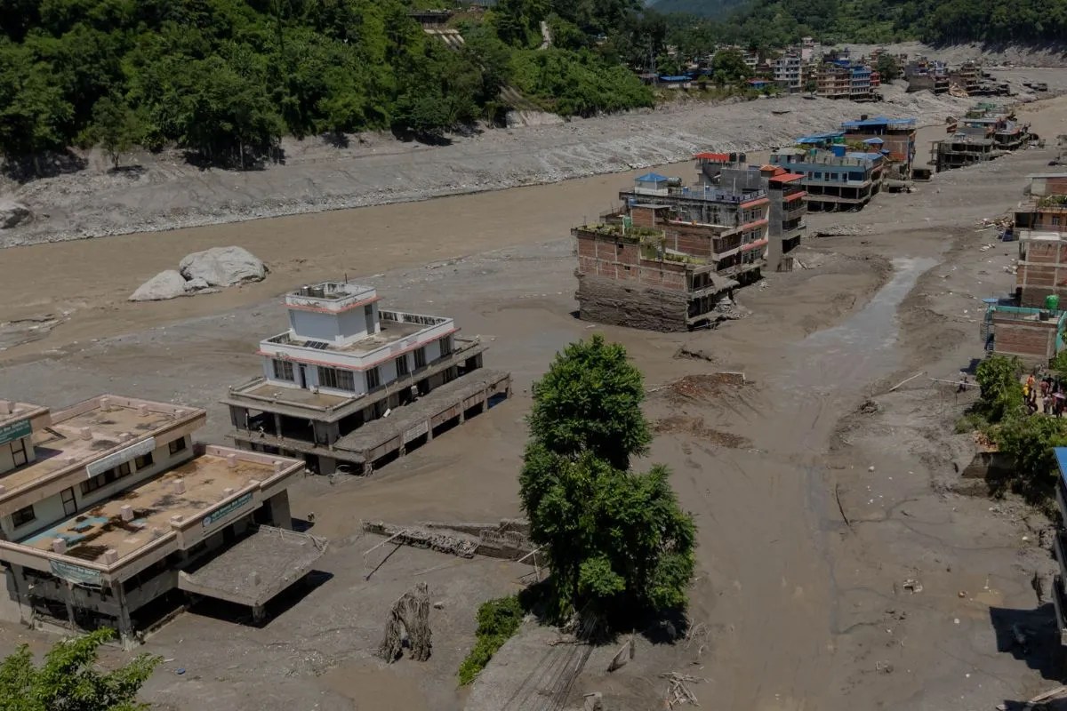
The water came down the Lhende Khola before dawn, carrying millions of tons of pulverized stone, blue glacial ice, and old-growth timber. It did not merely flood the valley; it erased it. By the time the roar reached the confluence of the Bhote Koshi and Trishuli rivers along the China-Nepal border, entire stretches of national highway, trade checkpoints, and hydropower infrastructure had been converted into gray slurry.
Initial reports pointed fingers in familiar directions. Local officials spoke of an earthquake, while regional analysts whispered of a classic glacial lake outburst flood, or GLOF. Both assumptions were wrong. Advanced satellite telemetry and seismic data compiled by international agencies later exposed a far more violent and unpredictable mechanism: a massive high-altitude glacial collapse. A section of a glacier at roughly 5,200 meters sheared off the mountainside, plunging vertically into the river gorge below and instantly generating a 5.2 magnitude-equivalent seismic shockwave entirely on its own. For a closer look into this area, we suggest: this related article.
The immediate devastation was only the opening act. As the debris flow temporarily choked the river channel, it birthed an unstable natural dam, pooling millions of cubic meters of water upstream and setting the stage for a secondary catastrophe that haunted rescue operations for days.
The Anatomy of High-Altitude Collapse
Understanding why the Hindu Kush Himalaya is tearing apart requires looking far above the treeline. For decades, scientific monitoring networks have recorded warming rates in these high-elevation zones at roughly five times the global average. Glaciers that took millennia to form are thinning, fracturing, and detaching from their bedrock foundations at an accelerating pace. For additional background on this issue, in-depth reporting is available at TIME.
When a mass of ice and rock weighing millions of tons drops a kilometer straight down into a narrow canyon, the laws of physics guarantee catastrophe. It is not just water moving downstream; it is a moving wall of abrasive debris that acts as a geological battering ram.
[Glacial Detachment at 5,200m]
              │
              ▼ (1.2km Vertical Drop)
[High-Velocity Impact on Lhende River]
              │
              ▼ (Debris Dam Formation)
[Upstream Pooling & Secondary Flood Risk]
This specific event near the Gyirong port crossing highlights a terrifying new normal. The danger is no longer restricted to the slow melting of ice or the gradual expansion of moraine-dammed lakes. It is the sudden, unannounced structural failure of the mountain itself. Traditional early-warning systems designed to detect rising water levels in downstream gauges are utterly blind to a chunk of a glacier breaking away in the upper atmosphere. By the time water sensors register a change, the destructive wave is already bearing down on human settlements.
The Mirage of Immediate Safety
When emergency engineering teams reported that the newly formed barrier lake near the border had begun to slowly drain on its own—reducing its surface area significantly over a 48-hour window—international headlines declared that the worst had passed. That assessment was dangerously premature.
The natural drainage of an impounded glacial lake through loose debris is rarely a clean process. Water cutting through fresh sediment creates new channels, destabilizing adjacent slopes that are already saturated by persistent monsoonal rains. Heavy machinery struggles to reach these remote altitudes, leaving disaster response units entirely dependent on aerial reconnaissance and drone-mounted radar to watch shifting mud walls.
Even as the immediate threat of a catastrophic wall-of-water breach recedes at one specific pool, engineers tracking the upper catchments have mapped larger, more volatile lakes sitting just out of sight. A single heavy cloudburst over these loose moraines can trigger a chain reaction, turning a manageable trickle into an aggressive flash flood within minutes. The margin for error in these steep Himalayan corridors is practically zero.
The Transboundary Blind Spot
Infrastructure development along the Himalayan spine has always been a game of calculated risk. Hydroelectric plants, cross-border trade routes, and arterial highways are squeezed into narrow river valleys because no alternative terrain exists. These corridors are economic lifelines for both China and Nepal, yet they are anchored in one of the most tectonically and glaciologically volatile landscapes on Earth.
Cross-border cooperation during acute crises often stumbles over bureaucratic friction and the sheer physical isolation of the terrain. While robotic drones and specialized engineering corps deploy advanced monitoring tools on the Tibetan side, the downstream transmission of real-time threat data to vulnerable communities in Nepal remains inconsistent.
Mitigating future disasters requires moving past reactive emergency responses. Standardizing real-time seismic-acoustic monitoring across the high frontier can buy precious minutes for evacuation, but it requires treating the entire river basin as a single integrated ecosystem rather than separate national territories divided by a mountain crest. Until transboundary hazard management matches the speed of glacial retreat, the valleys below will remain entirely at the mercy of the peaks above.