The digital map of the Red Sea currently resembles a chaotic hive of activity, but what millions of casual observers are seeing on their screens is only a fraction of the actual story. As regional conflict intensifies, ship-tracking platforms like MarineTraffic and VesselFinder have transitioned from niche tools for logistics nerds into the primary scanners for a world watching a slow-motion economic disaster. This surge in public interest isn't just about curiosity. It represents a fundamental shift in how modern warfare is monitored, verified, and influenced by open-source intelligence.
When a missile strikes a tanker in the Bab el-Mandeb strait, the data doesn't come first from a Pentagon briefing. It comes from a transponder signal that suddenly goes dark or a hull that begins a frantic, erratic circular pattern. This is the new reality of maritime security.
The Illusion of Total Transparency
The bedrock of this entire industry is the Automatic Identification System (AIS). Originally designed to prevent ships from slamming into one another in the fog, AIS broadcasts a vessel’s position, speed, and identity to anyone with a radio receiver or a satellite connection. It was never intended to be a secure military protocol.
Today, that lack of security is a massive liability. Commercial ship-tracking apps aggregate these signals to show a real-time global fleet. However, the picture they paint is increasingly distorted. In high-risk zones, "dark" ships have become the standard, not the exception. To avoid detection by hostile actors, captains are routinely killing their AIS transponders hundreds of miles before entering contested waters.
What the public sees on a tracking app is a curated, delayed, and often manipulated version of the sea. "Spoofing"—the act of broadcasting false coordinates to make a ship appear as if it is in one place while it is actually miles away—has evolved from a pirate tactic into a state-sponsored tool of deception. If you are watching a ship move through the Suez Canal on your phone, there is a non-zero chance that the physical vessel is actually off the coast of Oman.
Why the Data Boom Matters for Your Wallet
The sudden popularity of these apps among the general public stems from a direct connection to the kitchen table. Global trade relies on the predictability of the sea. When Houthi rebels began targeting commercial vessels, the "just-in-time" supply chain collapsed.
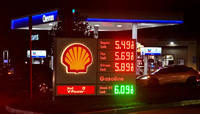
Insurance premiums for Red Sea transits didn't just rise; they mutated. Rates for war risk insurance jumped from roughly 0.07% of a vessel's value to over 1% in a matter of weeks. On a $100 million tanker, that is a million-dollar surcharge for a single trip. These costs are the reason your coffee, your electronics, and your car parts are getting more expensive. The ship-tracking app is simply the thermometer measuring the fever of global inflation.
The Logistics of the Long Way Around
The data shows a massive migration. Instead of risking the Suez Canal, a significant portion of the global fleet is now rounding the Cape of Good Hope. This isn't a small detour. It adds approximately 3,500 nautical miles and 10 to 14 days to a journey between Asia and Northern Europe.
- Fuel Consumption: An extra 10 days at sea burns hundreds of tons of heavy fuel oil.
- Carbon Footprint: The environmental goals of the shipping industry have been effectively trashed by the necessity of these longer routes.
- Container Scarcity: Because ships are spending more time at sea, they aren't back at port to pick up the next load, creating a phantom shortage of empty containers.
The Intelligence Trap
The democratization of maritime data has created a dangerous feedback loop. In past conflicts, movements of strategic assets were the domain of classified satellite imagery. Now, every person with an internet connection can track a US carrier strike group or a Russian "shadow fleet" tanker.
This transparency is a double-edged sword. While it allows journalists to verify claims of ship seizures or attacks, it also provides a low-cost targeting tool for non-state actors. You don't need a sophisticated radar network when you can buy a premium subscription to a maritime tracking service. The shipping industry is currently grappling with the ethics of providing real-time data that could, quite literally, be used to aim a drone.
The companies behind these apps are in a bind. Their business model relies on the open sharing of data, but that same openness puts their primary customers—the sailors—at risk. Some platforms have begun censoring or delaying data in specific high-risk zones, but in the digital age, once the signal is out, it's impossible to pull back.
The Rise of the Shadow Fleet
While the world watches the legitimate tankers through the lens of these apps, a massive "shadow fleet" operates in the grey spaces. These are often older vessels with opaque ownership structures, used primarily to transport sanctioned oil. They are the ghosts of the maritime world.
The shadow fleet rarely uses AIS correctly. They engage in "ship-to-ship" transfers in the middle of the ocean, moving oil between tankers to hide the point of origin. For the analyst, tracking these ships requires more than just an app; it requires synthetic aperture radar (SAR) and multispectral satellite imagery to "see" through clouds and darkness when the transponders are turned off.
The gap between what is shown on a tracking app and what is actually happening on the water is where the real money is made and lost. Hedge funds and commodity traders aren't looking at the same map you are. They are paying for proprietary data layers that combine AIS with satellite pings, port records, and even social media scrapes to predict where the next supply shock will hit.
The Weaponization of Information
The Middle East conflict has proven that information is just as much a weapon as a cruise missile. When a tracking app shows a ship being diverted, it sends ripples through the oil markets before the ship even changes its heading. Perception often drives the price of crude more than the physical reality of the barrels.
We are seeing the birth of a new kind of "citizen surveillance." Much like how flight tracking apps were used to follow the movements of government jets during the Ukraine invasion, ship tracking has become a form of public accountability. If a company claims it is no longer trading with a sanctioned regime, but its ships are spotted "going dark" near a specific terminal, the digital trail is nearly impossible to erase.
Managing the Risk of the Known
The surge in app downloads isn't a fad. It is an adaptation. As long as the chokepoints of global trade—Suez, Panama, Malacca—remain under physical or environmental threat, the need for real-time visibility will only grow. But we must be careful not to mistake the map for the territory.
A blinking green icon on a screen is a data point, not a guarantee. The true state of the seas is far more clandestine, dangerous, and complex than a user interface suggests. The maritime industry is currently being forced to choose between the safety of silence and the efficiency of transparency. It is a choice that has no right answer.
Companies must now invest in multi-layered intelligence that goes beyond basic AIS. If your supply chain strategy relies on public-facing tracking data, you are already three steps behind the crisis. The goal is no longer just to see the ships; it is to understand the intent behind their movements before the transponder is switched off.