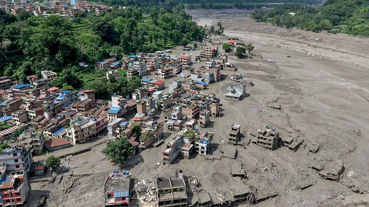
Cross-border environmental disasters expose systemic vulnerabilities in regional early-warning architecture, transforming localized flash floods into international friction points. When a massive surge of water breached the Tibet-Nepal border along the Bhote Koshi and Trishuli river systems, the physical devastation matched a recurring structural failure in bilateral crisis communication. Analyzing events of this magnitude requires moving beyond diplomatic rhetoric to evaluate the actual hydraulic mechanisms, data-sharing bottlenecks, and institutional design flaws that dictate survival outcomes in high-altitude terrain.
The Structural Mechanics of Himalayan Flash Floods
High-altitude drainage basins possess extreme hydrological volatility. The topography of the Tibetan plateau interfacing with the steep gorges of northern Nepal creates a compressed time-to-impact window for any sudden volume discharge. When glacial lakes breach, landslides dam narrow channels, or localized cloudbursts overwhelm catchment capacity, water volume scales exponentially over short horizontal distances. Learn more on a related issue: this related article.
The hydraulic shockwave that struck settlements like Timure and Syapru Besi originated in upper catchment zones characterized by severe topographical gradients. In such environments, downstream populations rely entirely on upstream telemetry data. Without automated sensor networks transmitting real-time discharge metrics across national borders, downstream communities operate blind. The kinetic energy of a debris flow moving down a steep canyon leaves zero margin for visual confirmation or reactive evacuation.
The Information Asymmetry Deficit
Effective disaster management depends on data velocity. In transnational river basins, upstream states hold a monopoly on hydrological observations because meteorological monitoring stations are geographically concentrated near the source zones. This creates an extreme asymmetry: the state vulnerable to the impact lacks direct access to the telemetry required to anticipate it. Additional reporting by NBC News delves into comparable views on the subject.
When upstream authorities fail to transmit discharge anomalies instantly, downstream emergency infrastructure is reduced to a post-hoc recovery apparatus rather than a proactive life-safety mechanism. Diplomatic frameworks often treat environmental data as sovereign property rather than a public safety utility. Consequently, institutional protocols fail precisely when milliseconds matter most. The absence of automated, bilateral data-sharing mandates transforms a natural hydrological hazard into an operational governance failure.
Evaluating Transnational Risk Transfer
Geopolitical friction frequently arises when ecological risks cross borders without proportional institutional safeguards. Downstream nations often adjust domestic and foreign policies to accommodate the strategic sensitivities of their larger neighbors, creating an imbalance in bilateral obligations. When environmental shocks originate from upstream territories, the downstream partner absorbs the entire human and economic cost.
This dynamic exposes the flaw in treating cross-border river management purely as a secondary diplomatic file. River systems ignore political boundaries; upstream construction, road expansion, and hillside modifications directly alter downstream runoff coefficients and sediment loads. If strategic cooperation is demanded on one side of the border, technical reciprocity regarding ecological hazard notification must be treated as a baseline operational requirement.
Strategic Operational Recommendations
Mitigating future catastrophic loss in trans-Himalayan river basins requires structural overhaul rather than rhetorical appeals. Regional disaster management frameworks must transition from discretionary communication to automated telemetry integration.
- Implement real-time, bi-directional hydrological data sharing using independent, satellite-linked sensor grids located upstream of sensitive border zones.
- Establish binding operational protocols that classify high-volume discharge warnings as mandatory public safety alerts, bypassing traditional bureaucratic channels.
- Decouple environmental hazard mitigation from broader geopolitical negotiations to ensure baseline data transmission continues regardless of diplomatic climate.
- Mandate joint environmental impact assessments for infrastructure projects situated within shared upper catchment basins to quantify altered runoff risks before construction commences.
The recurrence of preventable high-altitude disasters confirms that current bilateral warning mechanisms are fundamentally obsolete. Survival in volatile shared basins depends on treating hydrological data as an absolute humanitarian necessity, devoid of political friction or administrative delay.