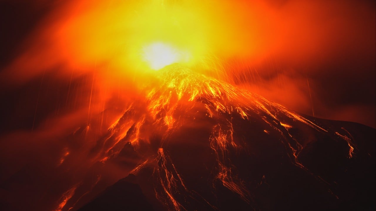
Volcanic events do not occur in isolation from human settlement patterns; rather, they represent a severe systemic collision between geological velocity and civic infrastructure. When Volcán de Fuego enters an active phase, emergency management agencies face a compressed operational timeline defined by ballistic projectile trajectories, pyroclastic density current generation, and lahar routing. Standard media reporting routinely reduces these crises to binary metrics of evacuation counts and ash plumes, masking the underlying vulnerabilities of hazard zone zoning, population density matrices, and institutional response latency. Effective crisis analysis requires deconstructing a volcanic eruption into its constituent physical mechanics, economic friction points, and evacuation logistics.
The Physical Mechanics of Fuego
Volcán de Fuego operates as a stratovolcano characterized by frequent, violent, vulcanian to sub-plinian eruptions. The primary physical hazards divide into three distinct operational vectors, each demanding a unique mitigation framework.
Pyroclastic Density Currents
Pyroclastic density currents represent the most lethal hazard associated with Fuego. These gravity-driven avalanches of superheated gas, ash, and rock fragments descend drainage channels at speeds exceeding one hundred kilometers per hour. Because these currents follow topography, their paths are largely predictable along specific barrancas, including Santa Teresa, Las Lajas, and Seca. Yet, human settlement directly adjacent to these natural spillways creates an immediate vulnerability window. Mitigation depends entirely on spatial separation rather than structural reinforcement, as no practical civil engineering protects against a three-hundred-degree surge carrying dense clastic loads.
Ash Fall and Atmospheric Dispersion
Continuous ash emission alters regional air quality, collapses agricultural yield, and compromises non-reinforced roofing infrastructure under heavy particulate accumulation. The distribution of tephra is governed by local wind shear vectors at varying altitudes. When prevailing winds transport particulate plumes toward urban centers such as Antigua Guatemala or Guatemala City, economic disruption extends far beyond the immediate hazard perimeter. Airports suspend operations, particulate inhalation causes respiratory systemic strain, and municipal stormwater systems clog, turning subsequent rainfall into localized flooding.
Secondary Lahars
Following primary eruptive phases, seasonal precipitation remobilizes loose pyroclastic material settled on the upper flanks of the volcano. These mudflows, known as lahars, possess the density of wet concrete and the kinetic energy to scour bridges, bury roadways, and dismantle permanent infrastructure. The hazard period for lahars persists long after the primary ash emission ceases, extending the emergency management lifecycle across multiple rainy seasons.
The Institutional Response Matrix
Civil protection authorities must execute rapid operational decisions under conditions of extreme informational uncertainty. The institutional response relies on monitoring networks operated by organizations like INSIVUMEH, which track seismic tremors, acoustic signatures, and thermal anomalies.
However, a persistent operational friction point involves the threshold for mandatory evacuation orders. Issuing an evacuation order prematurely incurs massive economic dislocation, temporary displacement costs, and community fatigue that can reduce compliance during subsequent events. Conversely, delaying the order until visual confirmation of a catastrophic surge eliminates the required lead time for safe civilian extraction.
Emergency management agencies utilize a tiered alert system ranging from green to red. Each tier prescribes specific operational protocols, including the activation of municipal emergency committees, the pre-positioning of rescue assets, and the opening of designated shelters. The efficacy of this matrix depends on the fidelity of communication channels between centralized scientific observatories and localized municipal leadership.
Infrastructure Vulnerability and Spatial Economics
The economic geography surrounding Fuego exacerbates physical exposure. High population density persists along the southern and eastern flanks because of fertile volcanic soils that support intensive agriculture, particularly coffee and maize. This creates an economic trade-off: agricultural yield maximization requires proximity to the hazard source, directly increasing human exposure to sudden-onset cataclysm.
Housing construction standards vary widely across the affected departments of Chimaltenango, Escuintla, and Sacatepéquez. Informal settlements featuring lightweight timber frames and corrugated metal roofing are exceptionally susceptible to structural collapse from minor tephra accumulation or blast shockwaves. Meanwhile, commercial infrastructure suffers from supply chain fragmentation as primary transit corridors, such as the RN-14 highway connecting northern and southern trade routes, experience frequent closures due to ash accumulation or lahar inundation.
Operational Resource Allocation
During active eruptive cycles, logistics optimization dictates survival outcomes. Emergency services must manage scarce assets across competing priorities:
- Clearing primary transport arteries to maintain evacuation corridors and supply lines for emergency medical teams.
- Establishing and supplying temporary displacement shelters with potable water, sanitation infrastructure, and medical triage units.
- Deploying search and rescue personnel into high-risk barrancas while balancing responder safety against humanitarian urgency.
- Issuing real-time public advisories to mitigate panic and prevent unauthorized re-entry into evacuated red zones.
Failures in any single vector cascade through the entire operational framework. For instance, an obstructed evacuation route strands vehicles within the ballistic or pyroclastic hazard zone, transforming a managed withdrawal into a mass casualty event.
Implement continuous structural reinforcement of secondary bypass routes around the RN-14 corridor to ensure freight and evacuation mobility remain intact during seasonal lahar activity. Municipal planning boards must enforce strict non-habitation zoning codes within the primary drainage barrancas, shifting agricultural use permits to cyclical land-use models that prohibit permanent structures in high-risk topographic depressions.