Waking up to your house bouncing like a trampoline isn't how anyone plans to start a Saturday. At 5:30 in the morning, a massive 7.7-magnitude earthquake struck off eastern Indonesia's Flores Island. It destroyed homes, triggered landslides, and killed at least 38 people.
If you're wondering how a country so accustomed to seismic activity still faces such devastating loss of life, you aren't alone. Let's look at what actually happened on the ground and why this specific disaster caught so many off guard.
The Reality of the Shaking on Flores Island
The quake hit at a shallow depth of about 10 kilometers, roughly 68 kilometers north-northwest of Ende in the East Nusa Tenggara province. Shallow earthquakes are notoriously destructive because the seismic energy doesn't dissipate before slamming into the surface.
Residents across the region felt the violent jolt. In Ruteng city, over 100 kilometers away from the epicenter, a university lecturer named Yulian Juita Ekalia described the experience vividly. She woke up to televisions flying off shelves, trophies tumbling down, and an intense motion that felt completely unstable.
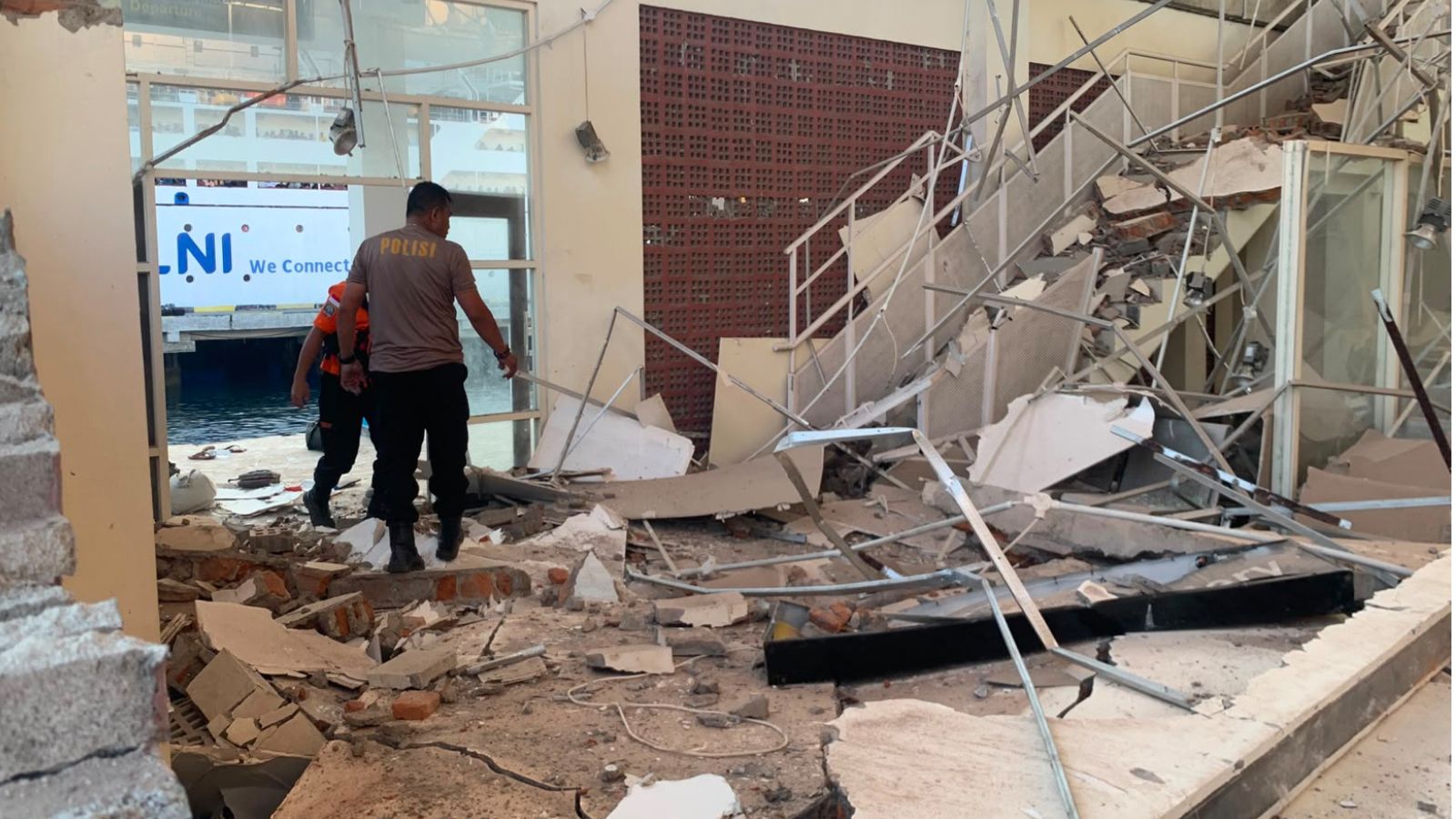
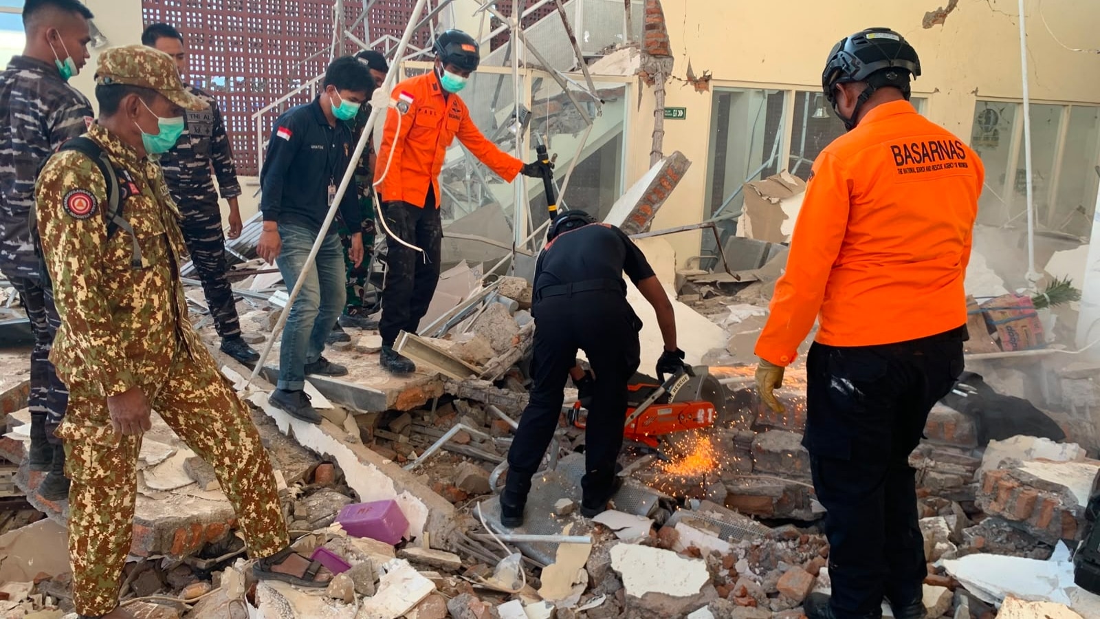
In the port town of Maumere, part of a terminal building crumbled into a cloud of dust and concrete. Hospitals had to wheel patients outside into the open air, setting up makeshift treatment areas on lawns because nobody knew if structural columns would hold up against the dozens of aftershocks that followed.
Why the Death Toll Climbed Fast
Indonesia's National Disaster Management Agency, known as BNPB, confirmed that the fatalities quickly reached 38, with dozens more injured and trapped beneath collapsed structures.
Several factors made this response uniquely difficult:
- Landlocked Debris: Landslides triggered by the initial tremor completely blocked sections of the 700-kilometer Trans-Flores highway, cutting off access to hard-hit areas like Nagekeo.
- Communication Blackouts: Power outages and downed phone lines left emergency services flying blind for hours.
- Sleeping Households: East Nusa Tenggara Governor Emanuel Melkiades Laka Lena noted that multiple victims were killed simply because the quake struck while they were still asleep, leaving them zero seconds to react.
Around 2,000 residents abandoned their homes entirely, fleeing to makeshift evacuation camps on higher ground while rescue helicopters were scrambled to drop emergency supplies.
The Tsunami Panic That Followed
Because the tremor was offshore, Indonesia's Meteorology, Climatology and Geophysics Agency immediately triggered a high-stakes tsunami warning. Coastal communities panicked, remembering historical nightmares like the devastating 1992 Flores earthquake.
Waves measuring under one meter eventually brushed the shorelines, but authorities canceled the alert roughly three hours later once tidal gauges confirmed no massive surge was coming. Even so, those three hours of uncertainty forced thousands of families to abandon their coastal homes on foot, scrambling up steep hillsides with whatever they could grab.
Living on the Ring of Fire
Why does this keep happening? Indonesia sits squarely on the Pacific Ring of Fire, an intense tectonic collision zone where major plates grind against each other constantly.
Earthquakes here aren't anomalies. They are a permanent fixture of geography. Yet, structural resilience remains uneven. While major tourist spots and cities slowly upgrade building codes, rural pockets and older infrastructure on islands like Flores remain highly vulnerable to sudden jolts.
Search and rescue teams are still combing through the rubble in Maumere and trying to clear the mountain passes into Nagekeo. If you are tracking travel plans or looking to support relief efforts in East Nusa Tenggara, keep a close eye on updates from local disaster response units as they restore communications and clear the blocked interior highways.